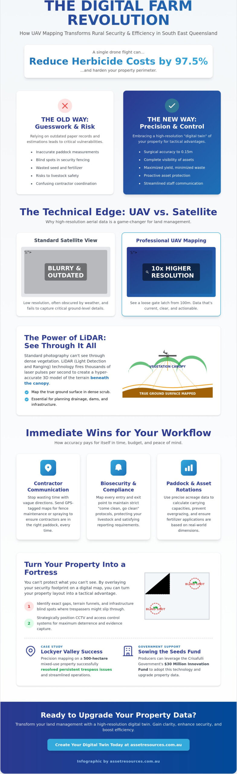
Could a single drone flight reduce your herbicide costs by 97.5% while simultaneously hardening your property perimeter? In South East Queensland, primary producers are achieving these results by using precision farm mapping as a digital twin for their daily operations. You already know that a blind spot in your fencing or an inaccurate paddock measurement is more than just a minor error. It’s a risk to your livestock, a waste of expensive seed, and a massive hurdle when you’re trying to coordinate contractors on the ground.
We agree that your land and equipment are your most valuable assets, and they deserve better than guesswork. This case study reveals how advanced UAV mapping transforms rural security and boosts operational efficiency for the 2026 season. You’ll discover how to leverage the Crisafulli Government’s $30 million Sowing the Seeds of Farming Innovation Fund to upgrade your property data. We also preview the latest CASA landholder regulations and show you how high-resolution LiDAR data creates a foundation for superior asset protection and biosecurity compliance.
Key Takeaways
- Leverage UAV and LiDAR technology to achieve 10x the resolution of standard satellite views, allowing you to penetrate thick vegetation and map hidden terrain.
- Identify critical infrastructure blind spots using professional farm mapping to ensure your CCTV and access control systems are positioned for maximum deterrence.
- Replace unreliable paper records with interactive digital datasets to eliminate equipment loss and streamline communication with new staff and contractors.
- Navigate CASA landholder regulations and site assessments with a structured execution plan that prioritizes operational safety and biosecurity compliance.
- Review a real-world case study from the Lockyer Valley where precision mapping resolved persistent trespass issues on a 500-hectare mixed-use property.
What is Farm Mapping and Why is it Essential for Brisbane Producers?
Farm mapping is no longer just a lines-on-paper exercise or a faded diagram pinned to the shed wall. It’s a high-resolution digital representation of your property’s infrastructure, terrain, and biological assets. For South East Queensland producers, this means moving away from static records and embracing interactive UAV-generated datasets. These digital twins allow you to zoom into a single gate latch or analyze a 500-hectare catchment with 0.15m vertical accuracy. This level of detail is the backbone of Precision agriculture, where every hectare is managed with surgical accuracy to maximize yield and minimize waste.
Accurate data is your first line of defense. You can’t protect what you can’t see. By overlaying your current security footprint onto a digital map, you identify the exact gaps where trespassers might slip through or where livestock might escape. It’s about turning your property layout into a tactical advantage, ensuring your assets are visible and your operations are streamlined.
The Core Benefits of Digital Land Management
Adopting a digital approach to farm mapping delivers immediate practical wins for your daily workflow. It simplifies complex tasks that usually eat up your time and budget. Consider these three areas where accuracy pays for itself:
- Contractor Communication: Stop wasting time with “the third gate on the left” directions. Send contractors a GPS-tagged map for fence maintenance or spraying to ensure they’re in the right paddock every time.
- Biosecurity Protocols: Map every entry and exit point clearly. This allows you to maintain strict “come clean, go clean” protocols, which is vital for compliance and protecting your livestock from outside contaminants.
- Paddock Rotations: Use 2026-standard acreage data to calculate precise carrying capacities. This prevents overgrazing and ensures your fertilizer and seed applications are based on real-world dimensions rather than estimates.
The Brisbane Context: Navigating SEQ Rural Challenges
Producers in the Brisbane hinterland and surrounding regions face unique geographic hurdles. In the Lockyer Valley, flash flood zones make contour surveys essential for infrastructure planning. A digital map helps you predict water flow and place your expensive equipment on higher ground before the rain starts. Meanwhile, producers in the Scenic Rim are dealing with a rise in rural trespass and equipment theft. Mapping your property bottlenecks allows you to place access control systems where they’ll actually work.
The Queensland Government is backing this shift. The Crisafulli Government launched a $30 million “Sowing the Seeds of Farming Innovation Fund” to help you adopt this tech. Aligning your property with the Queensland AgTech Roadmap 2023-2028 isn’t just about being modern; it’s about meeting the land use reporting requirements that are becoming standard for Brisbane primary producers.
The Technical Edge: UAV Mapping and LiDAR for High-Accuracy Data
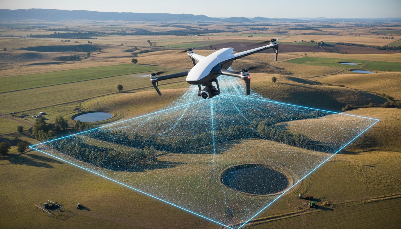
Satellite imagery often falls short when you need to inspect a perimeter fence or locate a specific asset in the scrub. While some platforms rely on government topographic data, professional farm mapping utilizing UAVs provides up to 10x the resolution of standard satellite views. This isn’t just about a prettier picture. It’s about seeing a loose gate latch or a cut wire from 100 meters up. When you integrate LiDAR drone technology, you gain the ability to “see through” dense canopy and scrub, which is common across South East Queensland.
LiDAR works by firing thousands of laser pulses per second to create a dense point cloud. This data allows producers to map the actual ground surface beneath thick vegetation, which is impossible with standard photography. This technical edge is a core component of the 3D Elevation Program standards, ensuring that your infrastructure placement is based on high-fidelity terrain models. Whether you’re planning a new dam or positioning CCTV Surveillance Systems at a property bottleneck, you need data that doesn’t guess.
UAV vs. Satellite: Why Resolution Matters
High-resolution imagery turns your map into a functional inspection tool. Instead of driving the entire perimeter, you use your drone to spot damaged fence lines or signs of weed infestation early. Centimeter-accurate data is also a prerequisite for the next generation of autonomous machinery. If your tractor’s GPS is off by half a meter because of poor mapping, you’re wasting fuel and chemicals. In-Farm has already demonstrated that drone-to-tractor weed identification can reduce herbicide use by up to 97.5% in Queensland. This level of precision is only possible when you move beyond generic satellite feeds.
Data Output: What Producers Actually Receive
A professional survey doesn’t just result in a single image. You receive a suite of actionable datasets tailored to your operations:
- Orthomosaic maps: These are high-stitch, top-down views where every pixel represents a real-world coordinate.
- Digital Elevation Models (DEM): Essential for drainage and flood mitigation, these models show exactly how water moves across your land.
- NDVI (Normalized Difference Vegetation Index): This identifies pasture health by measuring how plants reflect light, allowing you to target fertilizer where it’s needed most.
These digital outputs ensure your farm mapping data is delivered in standard formats like LAS for LiDAR. This makes the information compatible with modern ag-tech software and government reporting tools, giving you a professional-grade foundation for all future property developments.
Strategic Asset Security: Integrating Mapping with Surveillance
Effective property protection requires more than just hanging a camera on a shed. It demands a tactical understanding of your land. If you’re relying on a generic layout, you’re likely missing critical blind spots in your CCTV Surveillance Systems. By utilizing professional farm mapping, you can overlay camera fields of view on high-resolution imagery to see exactly what isn’t being watched. This allows for the strategic placement of Access Control Systems at property bottlenecks. These are the natural funnels, such as creek crossings or narrow ridge tracks, where intruders are forced to pass if they want to access your high-value assets.
Professional drone property surveys act as a comprehensive perimeter audit. They reveal where fences have been breached or where unauthorized tracks have been cut into the scrub by trespassers. When you combine this with the LiDAR data discussed earlier, you can plan Intruder Alarm Systems zones that account for topographic vulnerability. This ensures sensors aren’t blocked by sudden elevation changes or dense foliage that standard satellite views miss. It’s about building a security layer that works with your terrain rather than against it.
Mapping for Perimeter Protection
Unauthorized access tracks are a significant concern for producers on the Brisbane fringe, particularly in areas like the Scenic Rim. Mapping these vulnerabilities allows you to prioritize the installation of solar-powered security cameras in remote corners where mains power is unavailable. This data forms the basis of a Security Master Plan. It’s a living document that helps you scale your security footprint as your operations grow, moving from basic gate monitoring to full-perimeter awareness. The same principles that drive professional security camera installation Brisbane Southside — eliminating blind spots and meeting 8MP 4K standards for legal evidence — apply equally to rural properties where terrain complexity demands a data-driven approach. You can’t manage what you don’t measure, and you can’t protect what you haven’t mapped.
Asset Tracking and Inventory Management
Think about your high-value remote assets like diesel pumps, solar arrays, and chemical sheds. Mapping their exact GPS coordinates simplifies inventory management and maintenance. You can implement QR-coded map markers for maintenance logging, ensuring staff service the correct asset every time. Accurate gate mapping and property layouts are also vital for emergency services. In a 500-hectare property, providing a digital map to first responders can reduce response times by several minutes. This is often the difference between a contained grass fire and a total loss of infrastructure.
How to Execute a Professional Farm Mapping Project
Executing a professional survey requires a systematic approach to ensure the data is both legally compliant and technically sound. The process begins with a detailed consultation where we define your specific operational requirements, whether you’re focusing on infrastructure longevity or livestock security. We then conduct a site assessment to identify physical hazards like power lines and mobile towers while cross-referencing local airspace restrictions. This preparation ensures that when we deploy UAVs with professional-grade sensors, the farm mapping data capture is efficient and comprehensive.
Preparation and CASA Compliance in QLD
Engaging a CASA-certified pilot ensures your data meets the legal and insurance standards required for commercial-grade property valuations and liability protection. While the Landholder Rule allows some flexibility for private use, professional surveys must adhere to strict Standard Operating Conditions. This includes maintaining a 120-meter altitude ceiling and a 30-meter buffer from people not involved in the operation. Managing privacy is equally important; we recommend notifying neighbors at least 48 hours before the flight to maintain local relationships. Choosing the right weather window is critical, as high-quality contour mapping requires clear daylight for the 0.15m vertical accuracy mentioned earlier.
Software Integration and Training
The real value of farm mapping is realized when the data lives in your daily management software. We help move beyond static files by importing high-stitch datasets into platforms like AgWorld, GIS, or FarmMap4D. For producers tracking their budget, FarmMap4D subscriptions for 2026 range from the Lite version at $300 plus GST per year up to the Premium tier at $900 plus GST per year. Training your staff to use these interactive maps for task logging ensures the data actually gets used in the paddock. To keep your digital twin accurate, we recommend a seasonal re-mapping schedule, particularly after major infrastructure changes or significant weather events.
Ready to secure your property boundaries? Contact Asset Resources Group today to integrate professional mapping with our advanced Intruder Alarm Systems.
Case Study: Enhancing Operational Safety in the Lockyer Valley
In early 2026, a 500-hectare mixed-use property in the Lockyer Valley became a benchmark for what’s possible when you combine technical expertise with “boots on the ground” pragmatism. The producer was facing a dual crisis. First, rising trespass issues from the fringe urban spread were putting assets at risk. Second, the operation was bleeding money through “lost” equipment and inaccurate paddock records. Their existing paper maps were outdated, leading to a situation where seed and chemical orders were based on estimates rather than reality. We conducted a comprehensive integrated farm mapping and security audit to replace these guesses with hard data.
The transition from chaos to control followed a structured “Need – Expertise – Result” pattern. By treating the land as a series of high-value assets rather than just dirt, we were able to identify exactly where the operation was vulnerable. This data-driven approach led to a 15% reduction in operational waste and has resulted in zero security breaches since the system went live.
Phase 1: The Aerial Audit
The initial UAV survey yielded immediate, high-impact findings that paper records had missed for a decade. The high-resolution imagery discovered three unrecorded access points used by trespassers to enter the property from a neighboring bushland reserve. Furthermore, the survey corrected paddock boundaries that were previously out by 4.5 hectares. This error alone had caused years of over-application of fertilizers and herbicides. By processing LiDAR data through the dense scrub, the survey team identified a significant drainage channel that had been blocked by silt and debris for years, which was invisible to the naked eye and traditional satellite views. This discovery allowed for preemptive clearing before the SEQ storm season, protecting low-lying infrastructure from potential flash flooding.
Phase 2: Security Integration
Once the digital twin of the property was established, we moved to harden the perimeter. We installed mapped Access Control Systems at the main farm gate and the newly discovered secondary access points. We then deployed remote CCTV Surveillance Systems with views optimized by the 3D terrain model, applying the same professional security camera installation standards used across Brisbane to ensure 4K-resolution coverage that meets evidentiary requirements. This ensured that every camera was positioned to maximize its field of view, eliminating the blind spots that trespassers had previously exploited. The owner now manages the entire 500-hectare site using a mobile-ready interactive digital map. They can log maintenance tasks, track asset movement, and receive real-time alerts from Intruder Alarm Systems directly on their tablet. In the Lockyer Valley, precision farm mapping is the backbone of a safety-first operational culture that protects both the people and the profit.
Secure Your Property Assets with Precision Data
Adopting digital property management is no longer a luxury for Brisbane producers; it’s a requirement for operational resilience in 2026. By utilizing professional farm mapping, you move beyond basic boundaries to create a high-resolution digital twin that serves your security and your bottom line. We’ve discussed how LiDAR data and UAV technology provide the clarity needed to identify vulnerabilities that traditional satellite imagery simply misses. This level of detail ensures your infrastructure is protected and your daily operations are streamlined for maximum efficiency.
Asset Resources Group provides the technical expertise to turn these digital insights into physical results. Our team of CASA-certified UAV pilots and Brisbane-based technical specialists understand the unique challenges of the South East Queensland landscape. We focus on integrated rural security hardware, ensuring that your property data directly informs the placement of cameras and alarms. For producers who want to understand how these hardware components come together as a cohesive system, our guide to professional security system installation for Brisbane businesses outlines the integrated technology standards and compliance requirements that apply equally to rural and commercial sites. Don’t leave your perimeter to guesswork when you can have a master plan built on centimeter-accurate facts.
Take the first step toward a more secure and efficient operation. Request a Professional Farm Mapping & Security Consultation today. Your land and equipment are your most valuable assets, and they deserve the highest standard of protection available.
Frequently Asked Questions
What is the typical cost of farm mapping in Brisbane?
Most custom farm mapping services for standard properties range between $200 and $400; however, large or complex sites can exceed $1000. Subscription-based software like FarmMap4D costs between $300 and $900 per year depending on the selected tier. These prices vary based on the level of detail required and the total acreage covered.
How long does it take to map a 100-hectare property?
Data capture for a 100-hectare property typically takes between 2 and 4 hours of flight time. This duration depends on the terrain complexity and the specific resolution required for your security audit. Once the flight is finished, the processing phase to generate high-resolution orthomosaics and 3D models takes an additional 24 to 48 hours.
Do I need to be present during the drone flight?
You don’t need to be present during the drone flight as long as the pilot has clear access to the takeoff and landing zones. We recommend a brief initial site walkthrough to identify specific assets or areas of concern. This ensures the flight plan covers all critical infrastructure and avoids any localized hazards like temporary power lines or livestock movements.
Can farm mapping data be used for insurance claims after a flood?
Yes, high-resolution mapping data provides a verifiable snapshot for insurance claims. With vertical accuracy of 0.15m, these maps document changes in terrain and infrastructure damage with precision. This data is essential for proving the extent of siltation in drainage channels or the loss of fencing after a flash flood event in the Lockyer Valley.
What is the difference between NDVI and standard aerial photography?
NDVI measures how plants reflect light to determine health, whereas standard photography only captures what the human eye sees. NDVI identifies crop stress or weed infestations before they’re visible on a standard camera. This allows you to target herbicide or fertilizer applications with precision, potentially reducing chemical waste by up to 97.5% as demonstrated in recent Queensland AgTech trials.
Is farm mapping compliant with CASA regulations for rural properties?
Professional farm mapping services must adhere to CASA Standard Operating Conditions, including a maximum altitude of 120 meters. Under the Landholder Rule, farmers can fly drones up to 25kg on their own property for business purposes without a Remote Pilot Licence. However, commercial providers must maintain specific Operator Accreditations and stay at least 30 meters away from people not associated with the operation.
How often should I update my farm map?
We recommend updating your property map at least once per year or after any significant infrastructure changes. Annual updates ensure your Security Master Plan reflects current fence lines and gate locations accurately. Seasonal updates are also beneficial for producers tracking crop health or pasture rotation, as they provide a historical record for long-term land management decisions.
Can I integrate my existing security cameras into the digital map?
You can integrate existing CCTV Surveillance Systems into your digital map by overlaying their exact GPS coordinates and fields of view. This process identifies coverage gaps where intruders might slip through undetected. Mapping your hardware allows you to manage all cameras, alarms, and access control points from a single interactive interface, improving response times during a security breach.