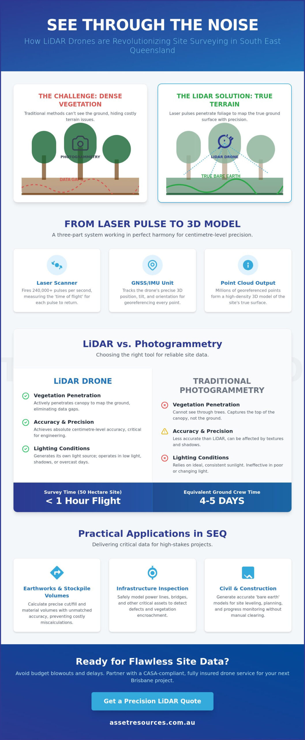
What if you could strip away every tree and shrub across a 50 hectare Brisbane site to see the true terrain in under an hour? For many project managers in South East Queensland, dense vegetation remains the biggest hurdle to accurate site data, often leading to construction errors that can blow out project budgets by 15% or more. A high performance lidar drone solves this by firing 240,000 laser pulses per second, penetrating even the thickest scrub to map the ground beneath with centimetre precision.
We understand that meeting tight project timelines in the local civil and construction sectors requires data that is both fast and flawless. You need more than just a birds eye view; you need a reliable digital twin that doesn’t hide secrets under the canopy. This guide shows you exactly how LiDAR technology is revolutionising asset protection and mapping across the region. You will learn the specific ROI of LiDAR over standard photogrammetry, identify key use cases for our unique terrain, and find out how to select a dependable partner for your next data collection mission.
Key Takeaways
- Understand how laser-precision spatial data outperforms traditional aerial photography to deliver superior accuracy for complex Brisbane site surveys.
- Discover the technical process behind how a lidar drone captures high-density 3D models, providing the “boots on the ground” detail needed for high-stakes asset management.
- Evaluate the cost-to-value ratio between LiDAR and photogrammetry to ensure you select the right tool for penetrating dense vegetation and achieving reliable site leveling.
- Explore practical applications for South East Queensland projects, from calculating precise stockpile volumes in earthworks to inspecting critical power and bridge infrastructure.
- Navigate the essential CASA compliance and safety requirements for Brisbane airspace to ensure your project remains fully insured and operationally sound.
What is a LiDAR Drone? Defining Precision Aerial Sensing
For asset managers and civil contractors across South East Queensland, the lidar drone has transitioned from an emerging tech piece to a site essential. It isn’t just a flying camera. To understand the mechanics, we first look at What is LiDAR (Light Detection and Ranging). This remote sensing method uses light in the form of a pulsed laser to measure ranges to the Earth. Unlike traditional photogrammetry that relies on visual imagery and ambient light, LiDAR generates its own energy. This allows for centimetre-level precision even in shadowed areas or under dense foliage.
Brisbane businesses are rapidly shifting from ground-based tripod surveying to aerial solutions to gain a competitive edge in mobilization speed. A professional-grade system integrates three critical components to ensure data integrity:
- The UAV (Unmanned Aerial Vehicle): A heavy-lift platform capable of stable flight in the variable wind conditions common along the Queensland coast.
- The Laser Scanner: A high-frequency sensor that emits hundreds of thousands of pulses per second.
- The GNSS/IMU Unit: A combination of Global Navigation Satellite Systems and an Inertial Measurement Unit that tracks the drone’s exact position and orientation in 3D space.
The efficiency gains are measurable. A single flight can capture 50 hectares of topographic data in under 30 minutes. Achieving the same result with a ground crew often takes 4 to 5 days of manual labor, depending on the terrain complexity.
How LiDAR ‘Sees’ the World
The system operates on ‘time of flight’ calculations. It measures exactly how long it takes for a laser pulse to hit an object and return to the sensor. High-end scanners record multiple ‘returns’ from a single pulse. This means the beam can clip a tree leaf, pass through a gap, and eventually hit the soil. A point cloud is the primary output of a LiDAR survey, consisting of millions of individual georeferenced points that form a digital 3D model.
Why LiDAR is Essential for Queensland Terrain
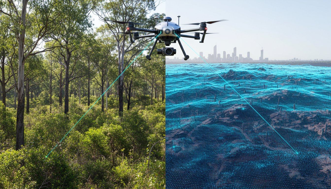
Mapping the dense coastal scrub and thick bushland around Brisbane and the Moreton Bay region is a notorious challenge for standard aerial photography. Traditional cameras can’t see the ground through the canopy, leaving massive data gaps. A lidar drone penetrates this vegetation to generate accurate ‘bare earth’ models. For civil projects, this capability is a game changer. On a typical 20-hectare site in SEQ, using aerial LiDAR can save a project team 14 days of manual clearing and ground-stamping. It provides a clear picture of the terrain without the need for expensive, time-consuming vegetation management before the survey even starts.
How LiDAR Technology Works: From Laser Pulse to 3D Model
A lidar drone operates on a principle called Time of Flight. The sensor emits rapid laser pulses, often exceeding 240,000 pulses per second, which bounce off surfaces and return to the receiver. By measuring the nanoseconds it takes for light to travel, the system calculates distances with surgical precision. To get a deeper grasp of the physics involved, the NOAA’s Lidar 101 resource explains how these light waves interact with various terrains and surfaces. It isn’t just about the laser, though. Reliable data relies on the Inertial Measurement Unit (IMU) and Real-Time Kinematic (RTK) positioning.
The IMU acts as the drone’s inner ear, recording every tilt, pitch, and roll during flight. Simultaneously, RTK provides centimetre-level geographic positioning by communicating with GPS satellites and a ground-based station. Without these two components, the laser data would be a jumbled mess of points without a fixed home in the real world. Once the flight ends, post-processing software takes over. It strips away “noise” like dust or birds and aligns millions of individual points into a cohesive 3D point cloud. This process transforms raw data into a functional map that Brisbane project managers can actually use for critical decision-making.
The Anatomy of a Laser Scan
Point density is the heartbeat of a successful scan. For Brisbane infrastructure projects, high density is required to map thin assets like power lines or complex scaffolding. Modern sensors are built to handle Queensland’s unique conditions, including high humidity and light dust. Calibrated sensors ensure that data remains repeatable. If you scan a site in January, the results must align perfectly with a follow-up scan in July. This consistency is why many firms choose to partner with technical specialists who maintain high-spec, industrial-grade equipment.
Data Visualisation and Outputs
The final output usually takes the form of a Digital Elevation Model (DEM) or a Digital Twin. A DEM is essential for flood risk assessments in the Brisbane River catchment because it filters out vegetation to show the true ground surface. Digital Twins go a step further, creating a living 3D model of an asset that evolves over its lifecycle. Most local engineering and security firms require data in .LAS, .LAZ, or .DXF formats to ensure compatibility with standard CAD software. These outputs allow teams to measure volumes, check clearances, and monitor structural integrity without setting foot in a high-risk zone.
LiDAR vs. Photogrammetry: Choosing the Right Tool for Your Site
Many project managers mistake photogrammetry for LiDAR because both technologies deliver 3D outputs. Photogrammetry uses overlapping high-resolution photographs to triangulate points and create models. It is a capable tool for open, flat sites with clear visibility. However, it falls short the moment you encounter complex terrain or shadows. A lidar drone uses active laser pulses to measure distance, providing a level of structural detail that cameras simply cannot match.
The choice often comes down to the initial investment versus long-term data value. While a professional photogrammetry drone setup might cost around A$8,000 to A$15,000, a survey-grade lidar drone system often starts at A$45,000. Despite the higher entry price, LiDAR provides superior value for large-scale Queensland infrastructure projects. It eliminates the need for manual ground-truthing in thick scrub, reducing field time by up to 50% on difficult sites. We often utilize hybrid approaches where visual RGB imagery is overlaid onto laser point clouds. This gives you the visual context of a photograph with the sub-centimetre precision of a laser.
The ‘Vegetation Test’ for QLD Projects
Standard drone photos fail in areas like the D’Aguilar Range or local SEQ bushland because they cannot see past the canopy. Photogrammetry creates a “digital surface model” that reflects the top of the trees, not the earth below. LiDAR is different. It uses multiple “returns,” where a single laser pulse filters through gaps in the leaves to hit the dirt. This allows us to strip away vegetation digitally to find the true ground level. In dense forested areas, LiDAR achieves a vertical accuracy of 30mm to 50mm, whereas photogrammetry can be inaccurate by 2 metres or more because it cannot “see” the ground.
Speed and Efficiency Comparison
Efficiency is where LiDAR dominates the workflow. Processing times are a major factor; photogrammetry requires massive computing power to stitch thousands of images together, often taking 24 to 36 hours for a large site. LiDAR data is ready for refinement almost as soon as the drone lands. This speed is vital for LiDAR in Land Surveying applications where rapid decision-making is required on-site.
- Night Operations: LiDAR is an active sensor. It doesn’t need the sun to map a site, allowing for 24/7 data collection in high-traffic areas where daytime flight is restricted.
- Deliverables: Choose photogrammetry if you need a visual map for a marketing presentation. Choose LiDAR if you need a structural model for civil engineering or volume calculations.
By understanding these technical boundaries, you ensure the data collected on day one is the data you can actually use for the duration of the project. We focus on delivering results that stand up to the scrutiny of site engineers and project stakeholders alike.
Top Use Cases for LiDAR Drones in Brisbane and SEQ
In Brisbane and the surrounding SEQ region, the lidar drone has moved from a niche tool to a project requirement. For earthworks and construction, the ability to calculate stockpile volumes with millimetre precision saves thousands in haulage costs. You aren’t just getting a photo; you’re getting a mathematical model of the site. This allows project managers to verify site levelling against design plans in real-time, ensuring that every cubic metre of soil is accounted for.
Critical infrastructure management across South East Queensland also relies on this tech. With over 3,000 bridges in the region and thousands of kilometres of power lines, manual inspections are slow and dangerous. Drones equipped with LiDAR can fly these corridors to identify structural fatigue or vegetation encroachment. It’s a proactive way to manage assets without the need for high-risk manual climbing or expensive helicopter wet-hires.
Environmental management is another area where the technology shines. Following the 2022 flood events, the need for accurate flood plain mapping became a priority for local authorities. LiDAR provides the elevation data necessary to model water flow and predict impact zones. Along the Gold and Sunshine Coasts, these drones track coastal erosion after major storm cells, giving councils the data they need to protect public infrastructure.
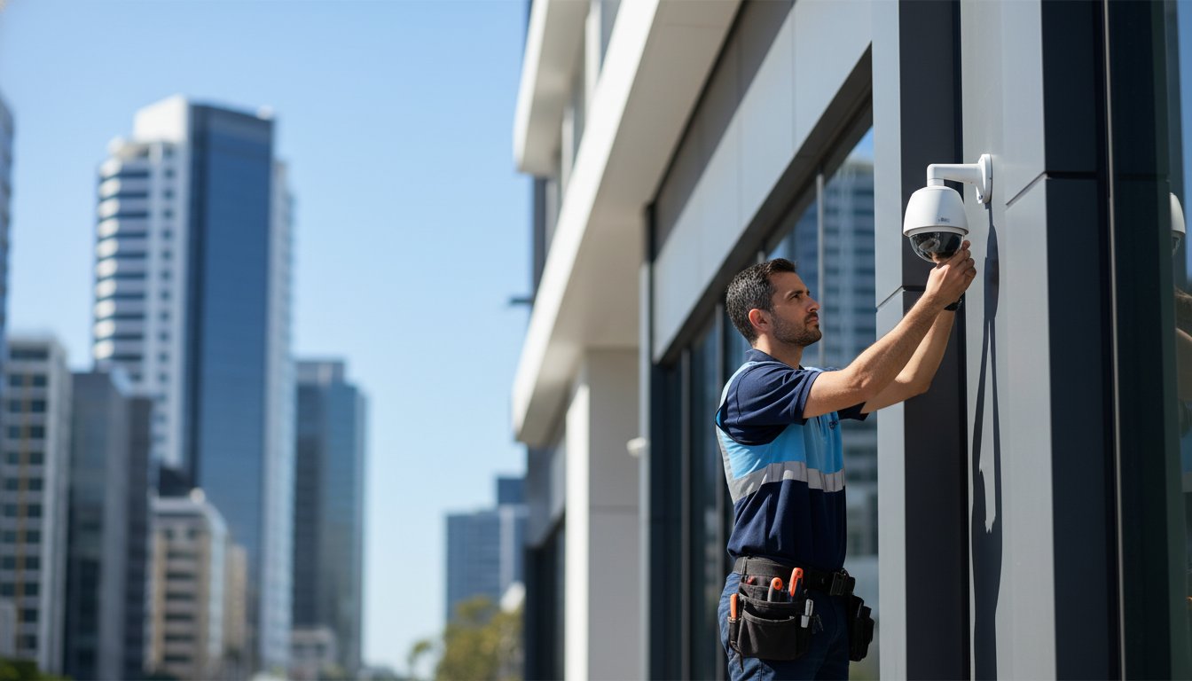
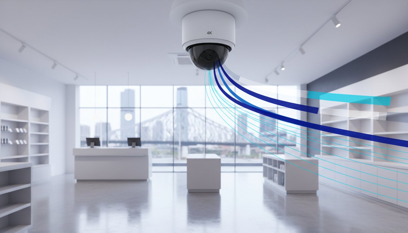
Security is also seeing a shift toward data-driven planning. By generating a high-resolution digital twin of a facility, security teams can strategically plan CCTV installation Brisbane. This ensures maximum coverage and eliminates blind spots before a single camera is mounted. For residential and commercial property owners in suburbs like Inala, Acacia Ridge, and Sunnybank, pairing precise site mapping with a professional security camera installation Brisbane Southside service ensures every entry point is covered to the 8MP 4K standard required for facial recognition and legal evidence. It’s a pragmatic approach that combines engineering data with asset protection.
Urban Development and Civil Engineering
Mapping the high-density urban corridors of the Brisbane CBD demands tools that handle complex verticality. A lidar drone excels here by capturing utility data and identifying existing assets before any ground-breaking begins. This level of detail supports local council planning and ensures project compliance throughout the development lifecycle. As South East Queensland accelerates its infrastructure pipeline ahead of the 2032 Games, integrating a drone property survey into your development workflow delivers the centimetre-level precision and rapid mobilization that modern Brisbane projects demand. It’s about reducing the risk of utility strikes and keeping projects on schedule.
Resource Sector and Industrial Inspections
In regional Queensland, the focus shifts to open-cut mining and large industrial assets. LiDAR systems monitor the structural integrity of massive installations without putting boots in high-risk zones. This safety-first approach is now the standard for industrial inspections. It allows for the rapid mobilization of mapping teams to monitor pit walls and stockpile changes while keeping your workforce out of harm’s way. Primary producers across SEQ are also applying these same precision techniques to their land holdings, and the results from farm mapping Brisbane case studies demonstrate how a single drone flight can dramatically reduce input costs while strengthening property perimeter security.
Partnering with a Brisbane Drone Service: Safety, Quality, and Compliance
Brisbane’s airspace is some of the most strictly regulated in Australia, particularly with the proximity of Brisbane Airport and Archerfield. Operating a lidar drone for commercial purposes requires more than just high-end hardware; it demands a deep understanding of Civil Aviation Safety Authority (CASA) Part 101 regulations. Hiring an unlicensed operator isn’t just a safety risk, it’s a legal liability. CASA can issue on-the-spot fines of A$1,565 for individuals, while corporate penalties can escalate quickly. We prioritize compliance to ensure every flight is legal, insured, and safe.
Working with professional UAV operators provides the peace of mind that your data is gathered ethically and accurately. Our team manages all necessary flight approvals and coordinates with Air Traffic Control when operating within restricted zones. This professional oversight ensures that your project stays on track without the threat of regulatory shutdowns or heavy fines.
Compliance and Risk Management
Our operations are built on the foundation of our Remote Operator’s Certificate (ReOC). This certification allows us to perform complex maneuvers that standard flyers can’t, providing the flexibility needed for dense urban environments or large-scale industrial hubs. Privacy is a significant factor when flying near populated Brisbane suburbs. We follow strict data management protocols to ensure we respect Australian Privacy Principles and only capture the data relevant to your asset.
Safety on industrial and construction sites is our highest priority. We don’t just fly over your site; we integrate with your existing safety culture. Our pilots follow site-specific inductions, establish clear exclusion zones, and perform dynamic risk assessments before every take-off. This “safety-first” approach ensures that lidar drone surveys never compromise the wellbeing of your ground crew or the integrity of your equipment.
The Asset Resources Group Advantage
We take a “boots on the ground” approach to Queensland asset protection. We aren’t just tech providers; we’re industry veterans who understand the high-stakes nature of the resource and civil sectors. We bridge the gap between digital data and physical site security. By integrating our aerial insights with professional security firms Brisbane, we provide a 360-degree view of your site’s vulnerabilities and maintenance requirements.
Our expertise lies in turning complex point clouds into simple, actionable plans. We strip away the technical jargon to give you clear maintenance schedules and security risk profiles. This practical focus has helped our partners reduce survey timelines by 60% and lower overall site management costs. We treat your project as a partnership, focusing on long-term value and operational excellence.
The next step in securing your site is scoping your specific requirements for a LiDAR survey. Contact our team today to consult on your specific Brisbane site needs and discover how our LiDAR solutions can protect your assets.
Future-Proof Your Brisbane Projects with Precision Sensing
Success in the Brisbane and SEQ construction sectors depends on accurate data and rapid mobilization. Implementing a lidar drone allows your team to bypass the limitations of traditional photogrammetry, capturing high-density 3D models even through dense vegetation or complex terrain. By moving from manual inspections to automated aerial sensing, you reduce site risk and ensure every project milestone meets strict Australian safety standards. It’s about getting the right results the first time, without the delays of outdated surveying methods.
Asset Resources Group brings a boots on the ground approach to every deployment. As a Brisbane-owned and operated team, we combine CASA-certified UAV operations with deep expertise in integrated security and asset management. We understand the local regulatory landscape and the technical requirements of the resource industry. Our focus remains on delivering tailored solutions that protect your people and your property while maintaining total compliance with CASA Part 101 regulations. We’re ready to help you optimize your site operations with local knowledge and industrial-grade technology.
We look forward to partnering with you on your next project to drive efficiency and safety across your site.
Frequently Asked Questions
Is a LiDAR drone better than a standard camera drone?
A lidar drone isn’t always better than a camera drone, but it’s far more effective for mapping terrain under thick Queensland scrub. While photogrammetry relies on clear sightlines and ambient light, LiDAR uses active laser pulses to find gaps in dense canopy. This makes it the superior choice for civil projects where accurate Ground Digital Elevation Models are critical for drainage and earthworks planning.
How much does a LiDAR drone survey cost in Brisbane?
Survey costs in Brisbane vary based on site size and mobilization requirements, though professional industrial rates reflect the high capital cost of the hardware. You’re paying for technical expertise and CASA-certified flight operations. Most Brisbane projects are quoted as fixed-price packages to ensure budget certainty for asset managers and construction leads who need reliable data without hidden fees.
Can LiDAR drones see through solid objects like roofs?
No, LiDAR pulses cannot penetrate solid materials like metal roofs, concrete slabs, or bricks. The technology relies on light reflection, so it stops at the first solid surface it hits. Its reputation for seeing through things comes from its ability to bypass 90% of leaf cover to hit the dirt below, which is vital for surveying remote Queensland bushland or forested development sites.
What is the accuracy of a drone-mounted LiDAR sensor?
Modern drone-mounted LiDAR sensors deliver vertical accuracy within 5cm and horizontal accuracy within 10cm at standard flight altitudes. These results meet the stringent requirements for Queensland Department of Transport and Main Roads surveying standards. Achieving these numbers consistently requires high-quality GNSS base stations and calibrated IMU sensors on the aircraft during every flight mission.
Do I need a special permit to fly a LiDAR drone in Brisbane?
Commercial operations in Brisbane require a Remote Pilot Licence and must be conducted under a Remote Operator’s Certificate issued by CASA. Much of Brisbane’s inner suburbs and port areas fall within restricted airspace due to Brisbane Airport and Archerfield. Operators must secure specific CASA approvals and follow Part 101 regulations for flights within 3 nautical miles of these controlled aerodromes.
How long does it take to process LiDAR drone data?
Processing a standard 50-hectare site usually takes 24 to 48 hours from the moment the lidar drone lands. This timeline includes data offloading, point cloud georeferencing, and noise filtering to remove vegetation or machinery from the final model. Rapid turnaround is a key advantage for Brisbane construction teams who need updated site volumes for weekly reporting cycles and project milestones.
What industries in Queensland benefit most from LiDAR?
Mining, civil infrastructure, and power utility sectors across Queensland see the highest return on investment from this technology. Energy companies use it to monitor vegetation encroachment on 330kV transmission lines, while open-cut mines use it for monthly stockpile audits. The ability to map 100 hectares in a single morning drastically reduces the safety risks associated with manual ground surveying in hazardous environments.
Can LiDAR drones operate at night or in low light?
Yes, LiDAR drones operate perfectly in total darkness because they carry their own light source in the form of laser pulses. Unlike standard cameras that need the sun to illuminate the ground, an active LiDAR sensor works 24/7. This capability allows for night-time surveys on busy Brisbane infrastructure projects where daytime flight might interfere with active crane movements or heavy highway traffic.