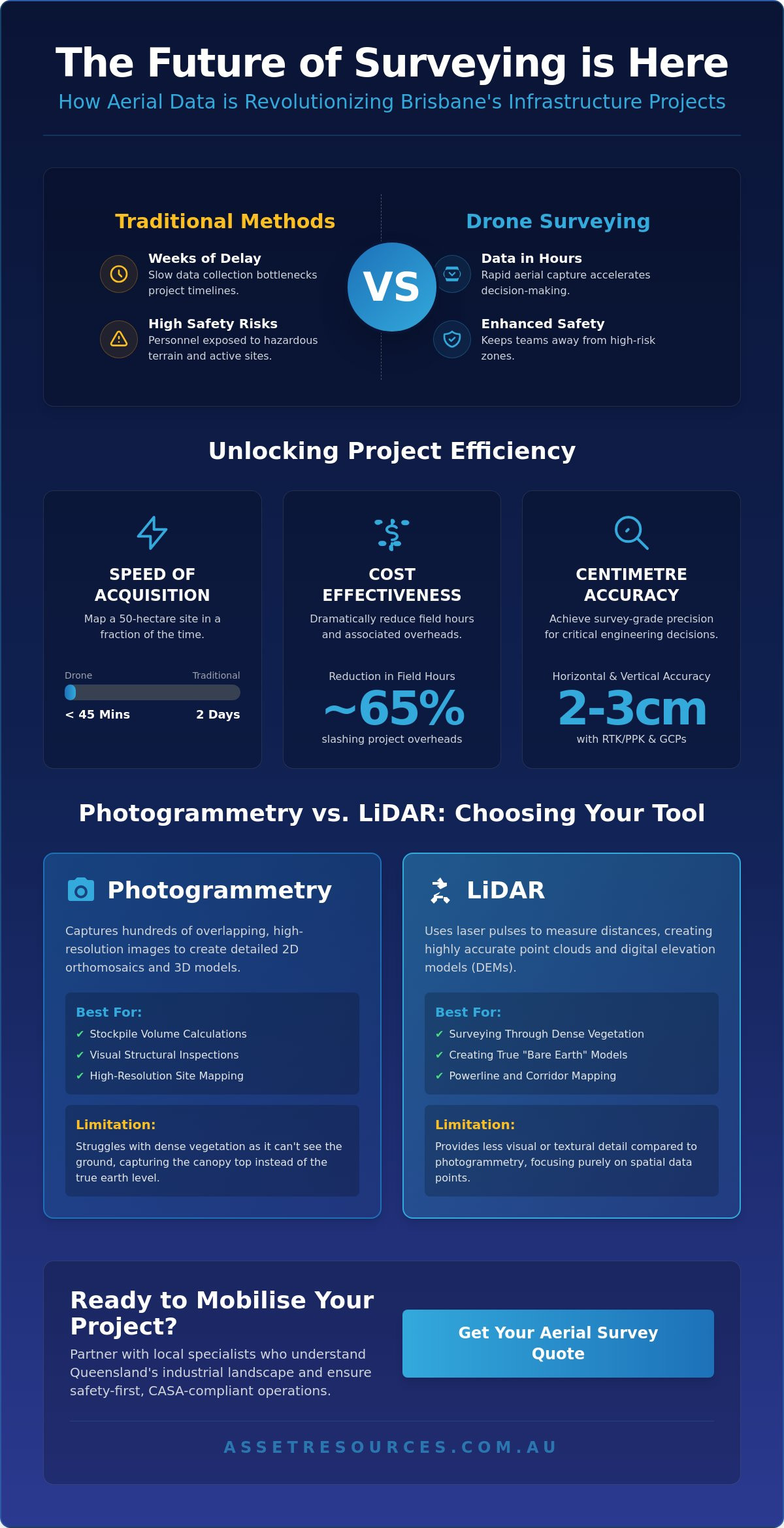
If your project timeline still relies on ground-based teams for every topographic update, you’re likely falling behind the 2026 pace of South East Queensland’s infrastructure boom. We know that traditional methods often struggle to keep up with the rapid mobilization required on modern Brisbane sites. Waiting weeks for site data or risking personnel in high-risk zones isn’t just inefficient; it’s a bottleneck that eats into your margins. Industry data from 2024 shows that drone surveying can reduce site inspection times by as much as 60%, providing a competitive edge you can’t afford to ignore.
This guide shows you how aerial technology is transforming asset management and construction by delivering centimetre-level accuracy in a fraction of the time. You’ll discover how to bypass the high costs of manned aircraft and clear the confusion surrounding CASA flight restrictions in urban areas. We’ll provide a clear roadmap for integrating high-resolution 3D mapping into your workflow, ensuring your next project stays ahead of schedule and maintains the highest standards of operational excellence.
Key Takeaways
- Discover how drone surveying transforms traditional data collection into high-accuracy aerial insights for Brisbane’s construction and asset management sectors.
- Learn to distinguish between Photogrammetry and LiDAR technologies to ensure you deploy the most effective mapping solution for your specific project assets.
- Explore real-world industry examples from South East Queensland that demonstrate how aerial data solves complex logistical challenges with a “boots on the ground” approach.
- Navigate CASA regulations with confidence by prioritising safety-first compliance for all urban aerial operations within the Brisbane metropolitan area.
- Identify the streamlined steps to mobilise your project quickly by partnering with local specialists who understand the unique requirements of the Queensland industrial landscape.
Understanding Drone Surveying: High-Altitude Data for Brisbane Projects
Brisbane’s industrial landscape is moving fast; project timelines are tighter than ever. Drone surveying has emerged as the primary solution for keeping pace. We define this process as the deployment of unmanned aerial vehicles (UAVs) equipped with specialised sensors to capture high-resolution geospatial data. It’s a significant move away from traditional “boots on the ground” methods that often slowed down site progress. By moving the data collection to the air, we’ve changed how civil and mining projects operate across South East Queensland.
This shift isn’t just about technical capability; it’s about safety. At Asset Resources, we view people as assets. Keeping staff on the ground and away from high-risk zones like unstable embankments or active haul roads is a priority. In the current 2026 construction cycle, South East Queensland projects have seen efficiency gains of up to 40% in data turnaround times. This reliability ensures that project managers make decisions based on yesterday’s site conditions, not data from two weeks ago.
The Core Benefits of Aerial Data Collection
The transition to aerial methods offers three distinct advantages for Brisbane infrastructure:
- Speed of Acquisition: A 50-hectare site that previously required two days of manual labour can now be mapped in under 45 minutes.
- Cost-Effectiveness: Reducing field hours by approximately 65% slashes the overhead costs associated with large-scale civil works and site mobilisations.
- Enhanced Safety: Aerial capture eliminates the need for personnel to enter hazardous terrain, steep slopes, or high-traffic areas, maintaining a safety-first culture.
How Accuracy is Maintained at Centimetre Level
Precision is the backbone of any successful project. To ensure survey-grade results, we use Ground Control Points (GCPs) across the Brisbane landscape. These are physical markers on the ground with known coordinates that anchor the aerial data. The industry relies on drone survey technology to convert these high-resolution images into accurate 3D models and orthomosaics.
For real-time precision, we utilise Real-Time Kinematic (RTK) and Post-Processed Kinematic (PPK) technologies. These systems correct GPS data in flight or during post-processing, ensuring horizontal and vertical accuracy within 2-3 centimetres. Ground Sample Distance (GSD) is the pixel-to-centimetre ratio that determines the level of detail in the final map. By maintaining a low GSD, we provide the granular detail required for complex engineering calculations and volume audits.
Photogrammetry vs. LiDAR: Choosing the Right Drone Survey Technology
Selecting the right technology for drone surveying isn’t about finding the “best” tool in a vacuum. It’s about matching the sensor to the specific assets you’re managing. A common misconception in the Brisbane industrial sector is that LiDAR always outperforms photogrammetry because the hardware is more expensive. That’s a mistake. High-quality data depends on the environment and your specific project goals. For project managers, the choice between these two methods dictates the accuracy of the site model and the overall mobilization timeline. Accessing this level of precision usually requires professional drone hire to ensure the sensors are calibrated correctly and flight operations stay within CASA regulations.
Photogrammetry: Creating High-Resolution 2D and 3D Models
This method works by capturing hundreds of overlapping high-resolution images from different angles. Specialized software then stitches these frames together to create a geo-rectified “orthomosaic” map or a textured 3D model. It’s the most effective method for visual-heavy tasks. If you’re calculating stockpile volumes on a civil site or conducting structural inspections of urban assets, photogrammetry provides rich, realistic detail. However, it has clear physical limits. In areas with dense Brisbane scrub or heavy vegetation, the camera can’t see the ground. This means the resulting data reflects the top of the canopy rather than the true earth level, which can lead to significant errors in site preparation if not accounted for by an expert operator.
LiDAR: Penetrating Vegetation for Accurate Terrain Mapping
LiDAR uses active laser pulses to measure distances instead of relying on ambient light. These pulses are capable of slipping through tiny gaps in foliage to hit the ground surface. This makes LiDAR essential for mapping Queensland bushland where ground visibility is poor. It’s the primary tool for creating a Digital Terrain Model (DTM) because it filters out “noise” like trees, cars, and buildings. While the technology requires a higher level of technical expertise to process, the results are indispensable for initial land surveys and flood modelling. For companies looking to maintain safety and quality during the early phases of a project, investing in LiDAR data prevents costly surprises once the earthmoving equipment arrives on site. If you’re unsure which sensor fits your next project, you can contact our team for a technical consultation on the best fit for your site.
5 Industry Examples of Drone Surveying in South East Queensland
Drone surveying has shifted from a novel technology to a project requirement across South East Queensland. In a region defined by rapid population growth and complex geography, the ability to capture high-resolution data quickly is a competitive advantage. Asset Resources applies a practical approach to these deployments, ensuring every flight delivers actionable intelligence for site managers and stakeholders.
Civil Construction and Earthworks
Developers working on large-scale housing estates in Ipswich and Logan face significant pressure to manage soil movement costs. Need: Accurate volume data to prevent budget blowouts during land clearing. Expertise: We deploy drones to capture topographical data, generating 3D point clouds with sub-5cm vertical accuracy. Result: Project managers receive precise cut-and-fill calculations, allowing for exact contractor invoicing and 90% faster volume reporting compared to traditional ground methods. These digital twins provide a permanent record of progress for investors and government compliance audits.
Industrial Asset and Roof Inspections
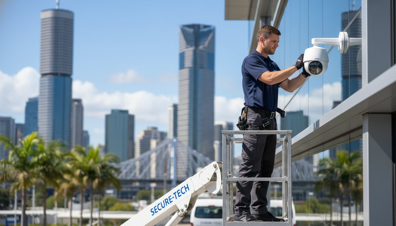
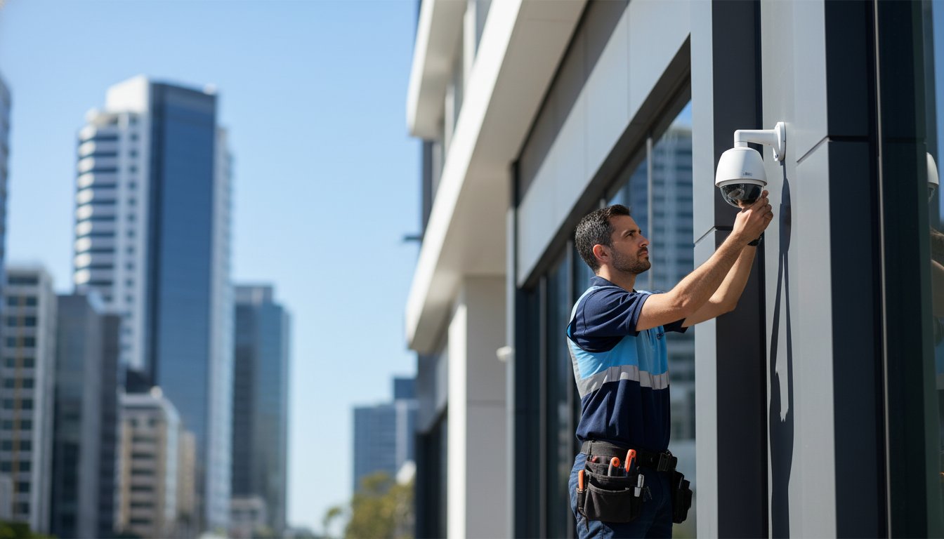
The Port of Brisbane houses some of the largest warehouse footprints in Australia. Need: Safe, cost-effective inspections of aging roof structures and solar arrays. Expertise: Using high-resolution thermal sensors, we identify moisture ingress and solar cell defects without the need for scaffolding or high-risk height work. Result: Facility managers reduce inspection costs by 70% while maintaining a safety-first environment. This aerial data is frequently used during the planning stages for CCTV installation Brisbane, ensuring security cameras are positioned with unobstructed lines of sight across complex industrial layouts.
Environmental and Coastal Management
Queensland’s coastline is a vital asset that requires constant monitoring against erosion and weather events. Need: Frequent, high-resolution mapping of the Gold Coast and Sunshine Coast shorelines to track sand movement. Expertise: We utilize multispectral imaging to map vegetation health and shoreline recession. These Industry Examples of Drone Surveying highlight how aerial data supports environmental offset requirements and flood risk modelling. Result: Local councils and environmental agencies use this data to design better sea walls and flood mitigation strategies for the Brisbane River catchment, protecting billions of dollars in coastal infrastructure.
- Infrastructure: Monitoring tall communication towers and bridges to identify structural fatigue without manual climbing.
- Solar Farms: Rapid thermal mapping of regional QLD solar assets to detect faulty panels that drain system efficiency.
- Compliance: Providing time-stamped visual evidence of site stabilization for environmental protection agencies.
By integrating drone surveying into standard operational workflows, South East Queensland businesses are seeing a direct correlation between better data and higher project margins. It’s about moving away from estimates and relying on a single source of truth captured from above.
Navigating CASA Regulations and Safety for Drone Surveys in Brisbane
Project managers often hesitate to integrate aerial data because Brisbane’s airspace feels like a legal minefield. It’s a valid concern. With Brisbane Airport (BNE) and Archerfield (YBAF) flanking the city, most metropolitan sites sit within controlled zones. At ARG, we don’t view these rules as hurdles. We treat compliance as a core safety-first metric that protects your project’s integrity and your company’s reputation. Compliance isn’t optional; it’s the foundation of every mobilization we undertake.
The gap between a hobbyist and a professional commercial outfit is vast. While a recreational flyer might risk a A$3,000 fine for a simple error, a corporate entity faces massive liability and voided insurance if they engage uncertified contractors for drone surveying. Understanding the full scope of CASA drone rules in Brisbane is essential for protecting your company from fines exceeding A$15,000 and ensuring every aerial operation meets the 2026 compliance standards. We eliminate that risk by sticking to a “boots on the ground” pragmatism where every flight is backed by rigorous documentation and CASA-approved safety protocols.
Understanding CASA ReOC and RePL Requirements
The Civil Aviation Safety Authority (CASA) splits certification into two distinct tiers. The Remote Pilot Licence (RePL) is the individual qualification held by the pilot. However, the Remotely Piloted Aircraft Operator’s Certificate (ReOC) is the business-level license that allows a company to fly for money. Professional drone operators must hold a valid ReOC to fly commercially in Australia. Hiring a firm without a ReOC means your site isn’t covered by professional indemnity or public liability insurance in the event of an incident. It’s a gamble that smart project managers won’t take.
Flight Planning in Controlled Brisbane Airspace
Flying a drone surveying mission in the Brisbane CBD or near the 5.5km exclusion zone of Archerfield requires more than just a charged battery. It requires a formal application to CASA and Airservices Australia. Our Chief Remote Pilot manages this process, ensuring every flight plan accounts for the 30-meter proximity rule and public safety requirements. We don’t just show up and fly. We coordinate with local authorities to secure “No-Fly Zone” exemptions, ensuring your data collection happens legally and without interruption.
Urban environments present unique challenges like signal interference and privacy concerns. We manage these through detailed pre-flight risk assessments (JHA/SWMS) and advanced obstacle avoidance technology. This disciplined approach ensures that whether we’re mapping a civil site in Pinkenba or a high-rise in South Brisbane, the result is high-quality data delivered without legal friction. If you need reliable data without the regulatory headache, you should partner with our certified drone surveying team to ensure your next project stays compliant and on schedule.
Mobilising Your Project: How to Partner with a Brisbane Drone Specialist
Successful project mobilisation in Brisbane’s construction and resource sectors depends on accurate, timely information. You aren’t just hiring a pilot; you’re engaging a technical partner who understands the local terrain and regulatory environment. By treating drone surveying as a foundational asset, project managers can mitigate risks before the first excavator arrives on site. This partnership approach ensures that data isn’t just a one-off snapshot. Instead, it becomes a continuous stream of intelligence that supports long-term asset management and site security.
Reliability comes from having boots on the ground. Local specialists provide the responsiveness required for the fast-paced Queensland market, where weather patterns or site conditions can change in hours. Integrating aerial data early creates a “single source of truth” for stakeholders, reducing disputes and keeping projects on schedule. It’s about moving from a reactive site challenge to a proactive data solution.
Defining Your Data Requirements
Precision starts with identifying exactly what assets you need to track. A civil project might require 2D orthomosaic maps for site layout, while a resource project requires high-resolution 3D models for stockpile volume calculations. You’ll need to decide on the survey frequency, as monthly captures are now standard for 85% of tier-one infrastructure projects in Australia to ensure compliance. Sensor choice is equally critical. For Brisbane’s more vegetated fringes, LiDAR is essential for ground surface penetration, while thermal sensors are the go-to for identifying heat signatures in electrical asset inspections.
From Deployment to Actionable Intelligence
The transition from flight to insight is where the real value lies. Modern drone surveying workflows allow raw data to be processed into geospatial intelligence within 24 to 48 hours. This rapid turnaround is vital for maintaining the momentum of a live site. These datasets aren’t isolated files; they’re designed to integrate directly into existing BIM or CAD environments. This allows engineers to overlay current site conditions against original design plans to identify discrepancies immediately.
- Streamlined data delivery via secure cloud platforms.
- Native integration with Revit, AutoCAD, and 12d Model.
- High-accuracy outputs tied to established site control points.
- Enhanced safety through reduced foot traffic in high-risk zones.
Choosing a partner with a “safety-first” culture ensures that your data collection meets the rigorous standards of the Australian resource industry. It’s time to elevate your project’s oversight with a team that values your people as much as your data. Partner with Asset Resources Group for professional Brisbane drone services.
Elevate Your Brisbane Project Efficiency
Efficient project mobilization in 2026 demands a strategic approach to aerial data. Whether you’re deploying LiDAR for terrain modeling or photogrammetry for detailed site inspections, the right technology ensures your South East Queensland project stays on schedule. Drone surveying has evolved into a critical asset for the mining and construction sectors, providing a safety-first method to capture high-altitude data without disrupting ground operations. It’s about getting the right information to the right people at the right time to drive better site outcomes.
Asset Resources delivers this technical edge through our CASA-certified pilots who hold full ReOC and RePL credentials. We understand the unique demands of industrial assets across Brisbane and the surrounding regions, offering integrated security and data solutions that prioritize site integrity and compliance with CASA Part 101 regulations. Our team brings a pragmatic, results-oriented focus to every mobilization, ensuring your data is accurate and your site stays secure. We’re ready to help you navigate the complexities of modern mapping with a no-nonsense approach to quality.
Request a Professional Drone Survey Quote for Your Brisbane Site to see how we can support your next phase. It’s time to build with confidence using local expertise you can depend on.
Frequently Asked Questions
Is drone surveying as accurate as traditional land surveying?
Drone surveying achieves survey-grade accuracy within 1 to 3 centimetres when our teams integrate Ground Control Points and RTK technology. While traditional methods remain necessary for legal boundary definitions, aerial data provides a higher density of data points across your Brisbane project site. You’ll receive millions of individual points compared to the hundreds captured by a total station, ensuring a more detailed digital model.
Do I need a permit to fly a survey drone over my Brisbane job site?
You must hold a Remote Pilot Licence and operate under a Remotely Piloted Aircraft Operator’s Certificate for commercial drone work in Australia. The Civil Aviation Safety Authority regulates these flights, particularly in restricted Brisbane airspace near the airport or Archerfield. We manage all compliance requirements and safety protocols to ensure your site stays operational without risking heavy fines from local authorities.
What is the difference between drone mapping and drone surveying?
Drone mapping creates visual representations like orthomosaics for site overviews, while drone surveying applies precise geographic coordinates to every pixel for engineering use. Mapping is excellent for general progress tracking and visual updates. Surveying involves rigorous data verification to ensure the outputs meet the technical standards required for accurate volume calculations and civil design work.
How much does a drone survey cost in Brisbane?
Costs depend on the total site area, the required data resolution, and the complexity of the local terrain. While we don’t offer fixed pricing due to the unique nature of each project, industry data suggests aerial methods can reduce traditional surveying labor costs by up to 40 percent on large civil sites. We provide tailored quotes that reflect your specific mobilization needs and project timelines.
What weather conditions can drones fly in for surveying?
Safe flight operations require wind speeds below 36 kilometres per hour and clear visibility without rain or heavy fog. High Queensland temperatures can also impact battery performance, so we often schedule flights during early morning windows to ensure equipment reliability. If conditions don’t meet our safety-first standards, we’ll reschedule the flight to maintain data integrity and protect the assets on site.
How long does it take to get the results from a drone survey?
You’ll typically receive processed data within 24 to 72 hours after the flight is completed on your site. Larger projects requiring complex 3D modelling or detailed contour mapping might take slightly longer depending on the total data volume. We prioritize a streamlined workflow so your project managers have the actionable information they need for upcoming site meetings or resource mobilization.
Can drones survey sites with dense trees or vegetation?
Drones equipped with LiDAR sensors can penetrate dense vegetation to map the underlying ground surface with high precision. While standard photogrammetry can’t see through tree cover, LiDAR pulses bypass leaves to hit the soil, providing an accurate Digital Elevation Model. This technology is vital for greenfield developments in the Brisbane region where thick scrub often hides the actual terrain profile.
What happens to the data captured during a drone survey?
Raw imagery is processed into professional formats such as Point Clouds, Digital Twin models, or CAD-compatible files like DXF and DWG. We store this data on secure, Australian-based servers to maintain strict compliance with local data sovereignty standards. Your team can then integrate these files directly into your project management software to track stockpile volumes, construction progress, and safety benchmarks.